Google's Eye in the Sky
April 6, 2005
Google's latest feature, satellite and aerial imaging in Google Maps is surprisingly fun. Google Blog describes it: A Bird's Eye View: "Now when you type an address into Google Maps, you can click the 'Satellite' link and see a view of the area. You can zoom, move the view by dragging, and even resize the window just like the normal 'Maps' view."
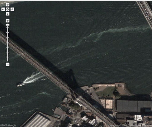
Some of the images available are stunning, such as boats in the East River and not traffic on the Brooklyn Bridge:
However, the images are stiched together from many different sources, some of which were taken at different times of the year:
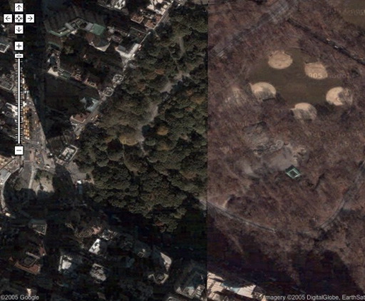
The Manhattan images were all taken early in the morning and the buildings cast long shadows. See Greg.org: Apparently, The Selfish Giant Lives on Fifth Avenue
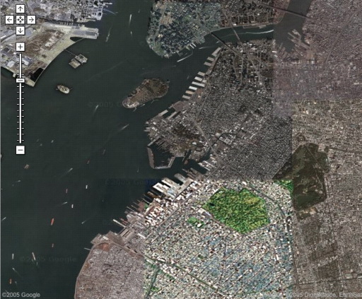
Some of the maps are composites from sources with different resolutions. One swath of Brooklyn is in much lower resolution than the rest:
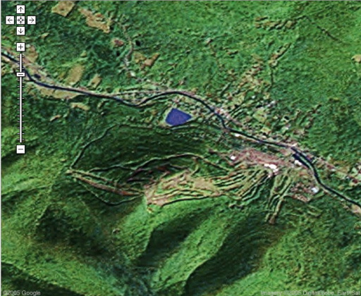
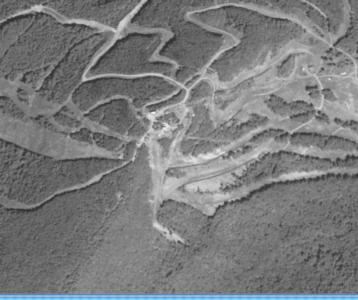
Although Google provides color images, some of the images it has are low resolution, such as for Hunter:
Terraserver has a higher resolution aerial photograph, but it is only available in black and white:
Additionally, the Google photos are significantly newer than those in Terraserver.
Ben Silverman is less than pleased with this level of currency: Google's Satellite Images: Cool, But Old "If nothing else, the satellite imagery is entertaining and I love having easy and free access to it. However, I can't get too excited about information that is eighteen months to two years old - not in this wired world we live in."
Metafilter: Freaky Cool or Just Freaky? with links to interesting sites.
Jason Kottke: Google Maps and user experience "The ability to view satellite images online has been around for years... why is everyone so excited about it?"
The interface on Google maps is so transparent that it feels more like looking at a map than searching through a database. Because google Maps is so much faster and slicker than Terraserver, it is simply much more fun.
Update (4/8):
Google Sightseeing points out interesting finds.
Google maps may increase public and corporate accountability by providing public access to aerial and satellite imaging information. Mezzoblue: Google Maps and Accountability
Posted by Andrew Raff at April 6, 2005 05:56 PM